
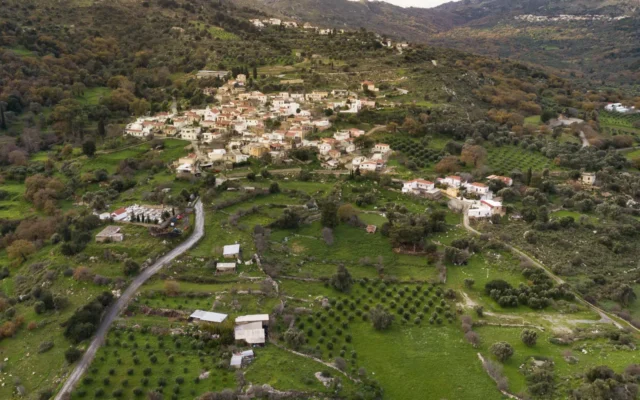
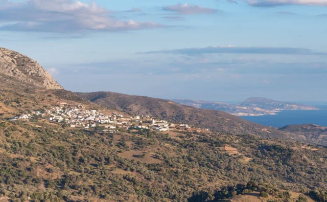
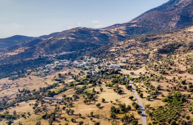
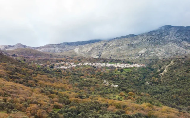
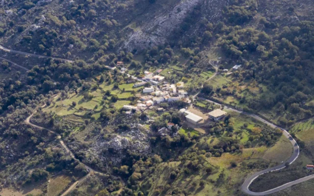
Vizari is a village and the seat of its corresponding community in the Amari Municipality, within the Rethymno regional unit on the island of Crete, Greece. It is situated 37.5 kilometers from Rethymno and is built in a valley known as Asomatianos Kambos, at an altitude of 360 meters. The area is known for its production of olive oil and livestock products. A reservoir is located near the village.
Historical References
At Vigla or Pyrgos, a hill about one kilometer south of the village, pottery shards and settlement remains from the Classical and Hellenistic periods were discovered in an area measuring 100 by 100 meters. Also at the same location, John Pendlebury identified pottery shards from the Roman period in 1935. At the site of Ellinika, two kilometers west of the village, the remains of a Roman settlement have been excavated, including a bath with a mosaic floor. A pit-shaped tiled roof tomb from the Roman period has also been excavated in the same area. Inside, two burials and the skeleton of a child were found. It is unknown if there were other tombs in the area that were destroyed.
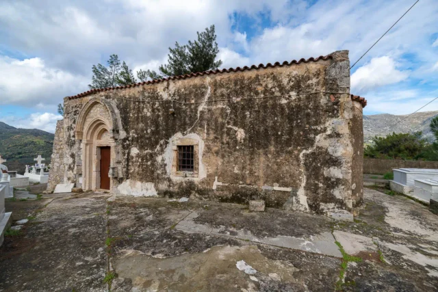
The remains of a basilica from the early Byzantine period are also preserved at the Ellinika site. Its large size and the presence of a synthronon suggest that it was the seat of a bishop, possibly of the diocese of Syvritos. Konstantinos Kalokyris pointed out that the city probably moved from its old location, above the village of Thronos, for defensive reasons during the first Byzantine period. He places the construction of the basilica between the late 7th and early 9th centuries AD, before the Arab settlement in Crete. It is possible that the church was destroyed by the Arabs.
The village is also mentioned by Francesco Barozzi in 1577 as Visari. In the Venetian census of 1583 by Castrofylaka, it is listed as Visari with 130 inhabitants.
The village’s association with the Vlastos family during the Venetian period further underscores its historical significance. As a fiefdom of this influential family, Vizarion likely played a role in the region’s political and economic landscape during Venetian rule. The remains of the Venetian palazzo and the sundial with Latin numerals serve as tangible reminders of this era.
Location
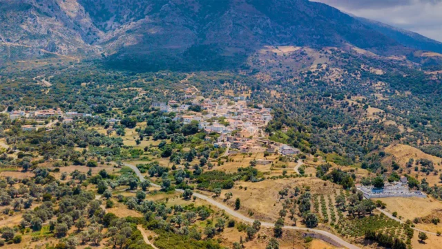
Vizari’s location in the Asomatianos Kambos valley, nestled amidst the mountains of the Amari region, has shaped its development and character. The village’s altitude of 360 meters provides a moderate climate and scenic views of the surrounding landscape. The valley’s fertile soil and proximity to water sources have likely supported agricultural activities throughout the village’s history.
Historical Significance
Vizari’s historical significance lies in its multi-layered past, spanning from the Classical and Hellenistic periods to the Venetian and Ottoman eras. The archaeological remains scattered throughout the area, including the Roman settlement, the early Byzantine basilica, and the Venetian palazzo, provide tangible evidence of the village’s rich and diverse history.
The village’s association with significant historical figures, such as the chieftain Anyfantis the Vizarinian and the scholar Emmanuel Leon Kaounis, further enhances its historical importance. These individuals, through their actions and contributions, have left their mark on the village’s legacy and shaped its place within the broader historical narrative of Crete.
Population Data Over the Years
Census Year |
Population |
|---|---|
1900 |
236 |
1920 |
237 |
1928 |
221 |
1940 |
233 |
1951 |
221 |
1961 |
202 |
1971 |
132 |
1981 |
116 |
1991 |
111 |
2001 |
88 |
2011 |
89 |
Points of Interest
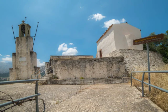
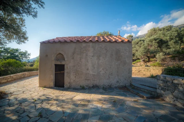
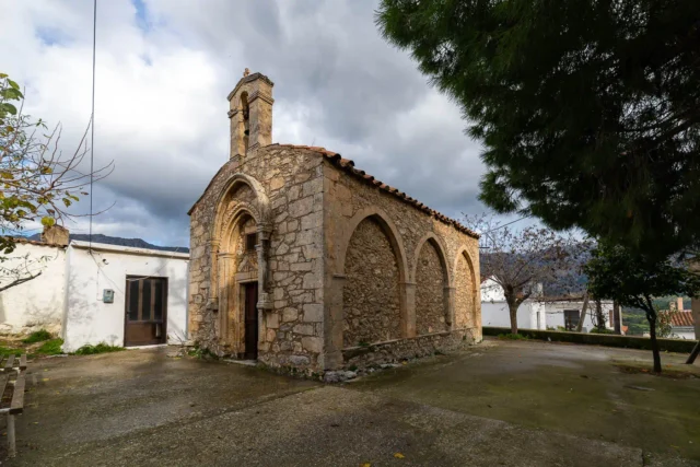
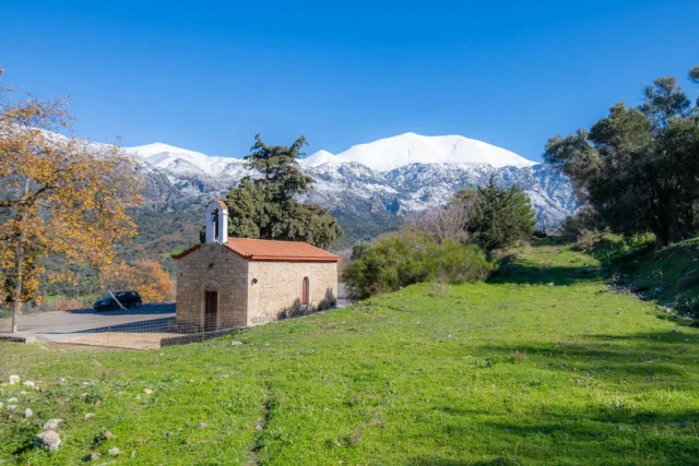
About 150 meters northwest of the village is the old single-nave church of Agios Nikolaos. The church is frescoed, although few of the frescoes survive, which date from the 14th-15th centuries. Near the village, there is an old watermill for grinding grains. The watermill has been characterized as a historical preserved monument because it is a remarkable building of special function from the pre-industrial period, a valuable and characteristic example for the study of the history of architecture, inextricably linked to the memories of the residents of the area.
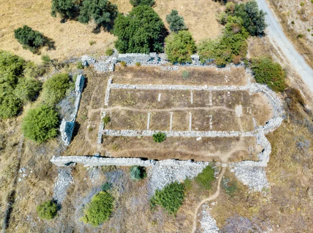
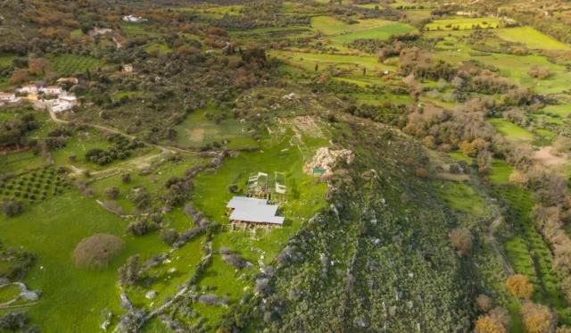
At the site of Rimokklisia or Ellinika, about two kilometers west of the village, are the ruins of a large basilica from the early Christian period. The basilica has dimensions of 34.2 by 17.3 meters and its walls are preserved to a great height. The basilica was three-aisled, with the aisles separated from each other by colonnades which rested on a high stylobate that prevented communication between the aisles. The entrance to the three aisles was through an equal number of doors in the narthex of the church. It was excavated in the 1950s and 1958 by Konstantinos Kalokyris.
Current Status
The presence of historical and archaeological sites offers potential for cultural tourism. These landmarks, along with the village’s natural beauty and tranquil setting, attract visitors interested in exploring Crete’s rich history and cultural landscape. The village’s efforts to preserve its historical and cultural heritage, along with its participation in the Amari Municipality, demonstrate its commitment to its future and its place within the broader regional context.
Village Key Points
- Historical References: The village is first mentioned in 1577 as Visari and has been documented in various censuses and historical records since then.
- Location: Vizari is situated in the Amari Municipality, in the Asomatianos Kambos valley, at an altitude of 360 meters.
- Historical Significance: Vizari has a rich history dating back to the Classical and Hellenistic periods, with evidence of Roman and Byzantine settlements. The village features a preserved Venetian palazzo, a historic watermill, and the ruins of an early Christian basilica.
- Population Data Over the Years: The population has declined over time, from a peak of 237 in 1920 to 89 in 2011.
- Current Status: Vizari is a small village with a focus on agriculture and livestock farming. It is part of the Amari Municipality and features several historical and archaeological sites of interest.
Access
Vizarion is 16.4 kilometers away from the town Tympaki and 0.9 kilometers away from Fourfouras


There are no comments yet.