A Bastion of Ottoman Control in Crete
The island of Crete, with its strategic location in the Mediterranean Sea, has been a coveted territory for various empires throughout history. During the Ottoman rule in the 19th century, the need to maintain control over this often-rebellious island led to the construction of numerous fortifications, including the Koules (towers) strategically placed across the Cretan landscape. Among these is the Koules in Koxare, a silent sentinel bearing witness to the island’s turbulent past.
Historical Context
The 19th century was a period of intense struggle for the Cretan people, who yearned for freedom from Ottoman rule. The island was rife with uprisings and rebellions, often met with brutal suppression by the Ottoman forces. To strengthen their control and quell the rebellious spirit of the Cretans, the Ottomans embarked on a massive construction program of fortifications, including the Koules.
The Koules Network
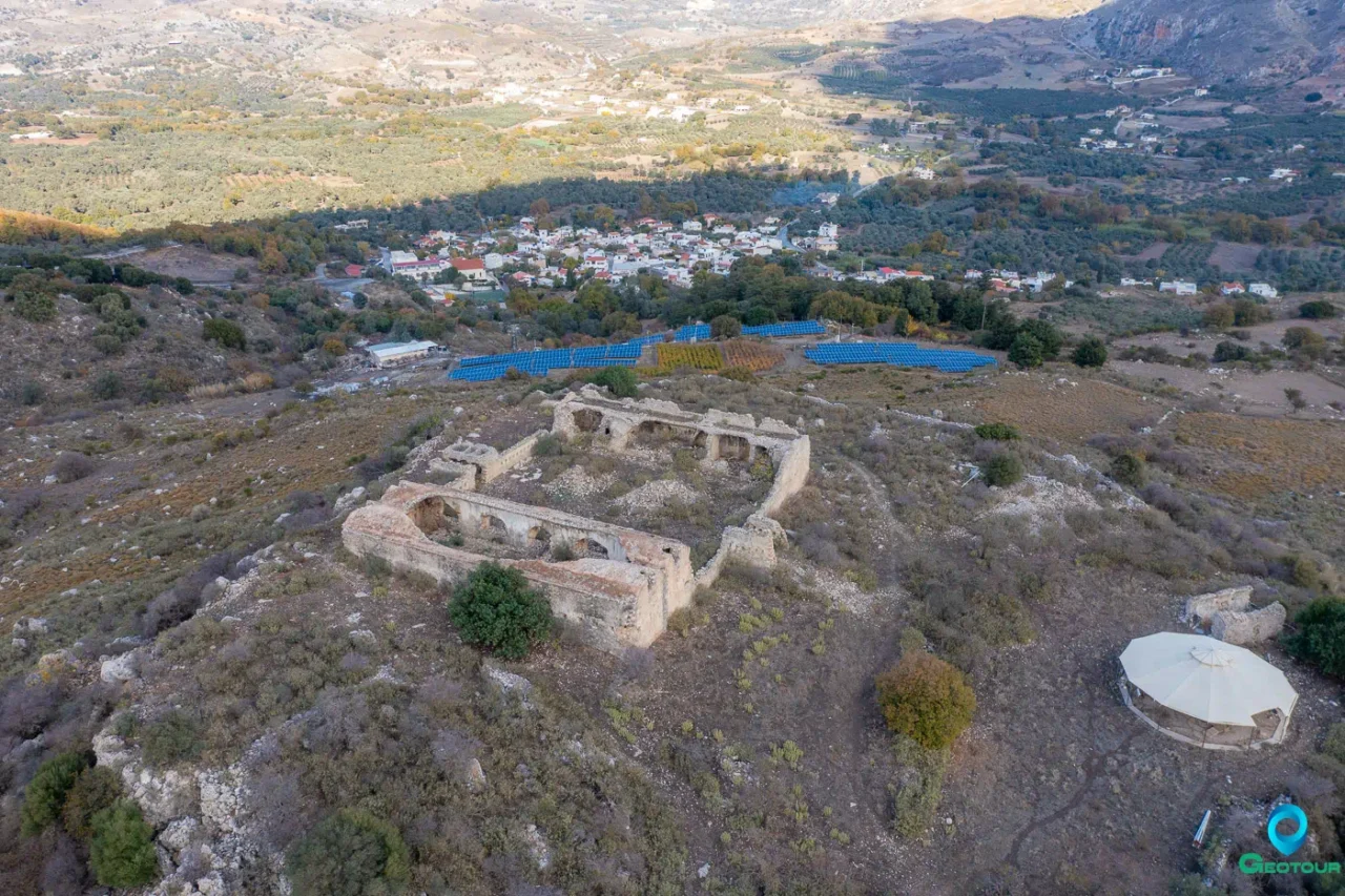
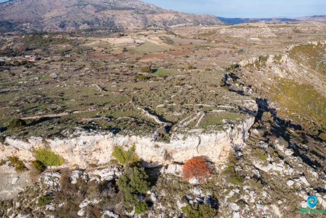
The Koules were strategically positioned across the island, forming a network of military surveillance and control. They were typically built on high ground, enabling the Ottoman forces to monitor the movement of rebels and maintain a watchful eye over the local population. The Koules in Koxare, located near the entrance of the impressive Kourtaliotiko Gorge, was a crucial part of this network, controlling the primary passage between the Messara Plain and Sfakia.
The Koxare Koules
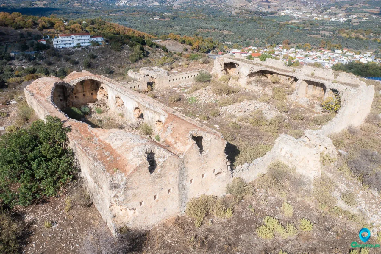
The Koxare Koules is a remarkable example of Ottoman military architecture in Crete. Although partially destroyed by Cretan revolutionaries in 1896, its remaining structure still stands as a testament to its former strength and strategic importance.
Architectural Features
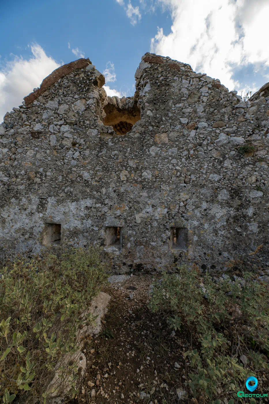
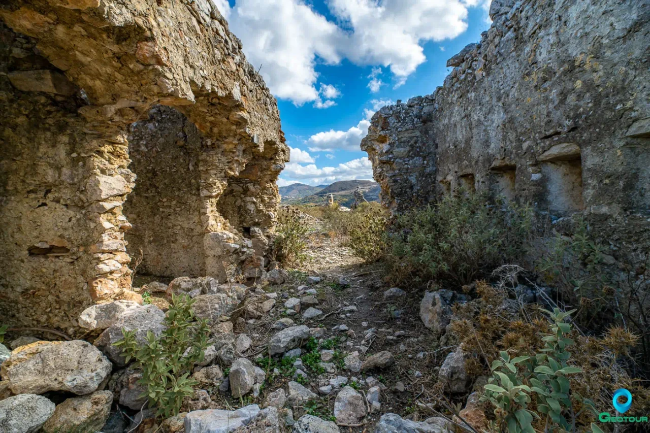
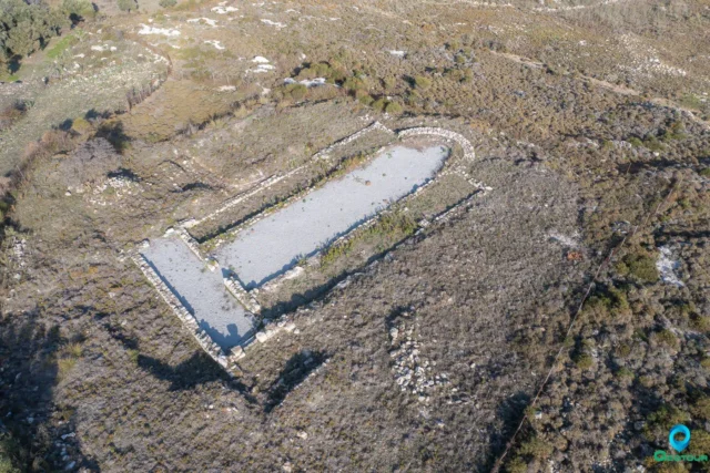
The Koules is characterized by a large internal courtyard, once surrounded by two-story buildings on the west side, their roofs supported by high arches. The eastern side housed a structure with a lower arch spanning its entire length. Access to the Koules was facilitated by a ramp on the south side, leading to an enclosed entrance area. The entire structure was built using local off-white stone and a strong mortar, with both interior and exterior walls plastered. The thickness of the stonework measures 1.20 meters.
Current State
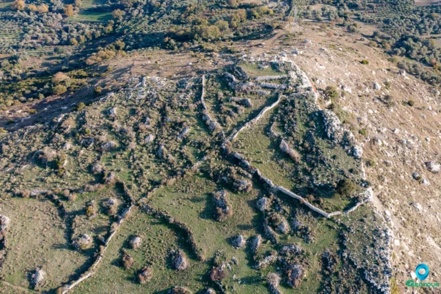
Today, the western and eastern buildings of the Koules have collapsed, leaving only the sturdy perimeter walls and the remnants of the arched structures. A rainwater collection cistern, still bearing its original internal hydraulic plaster, can also be found on the site.
Significance and Preservation
The Koxare Koules represents a significant chapter in Crete’s history under Ottoman rule. It symbolizes the struggle for control between the Ottoman rulers and the Cretan people. The remaining structure serves as a poignant reminder of the island’s fight for freedom and the strategic measures employed by the Ottomans to maintain their grip on power.
Despite its partial destruction, the Koxare Koules remains an important historical landmark. Its preservation is crucial for understanding Crete’s complex past and appreciating the architectural legacy of the Ottoman era. Efforts should be made to protect and maintain this significant site, ensuring that future generations can learn from and remember this turbulent period in Crete’s history.
The Future of the Koxare Koules: Potential for Preservation and Tourism Development
The Koxare Koules, though partially in ruins, holds significant potential for preservation and development as a historical and cultural site. Its strategic location near the Kourtaliotiko Gorge, a popular tourist destination known for its natural beauty and biodiversity, could be leveraged to attract visitors interested in exploring the intersection of Crete’s natural and historical landscapes.
Preservation Efforts: A Call to Action
The current state of the Koxare Koules calls for immediate and comprehensive preservation efforts. The remaining structure is vulnerable to further deterioration due to natural elements and the passage of time. A detailed survey and assessment of the site’s condition are necessary to develop a comprehensive preservation plan. This plan should include measures to stabilize the existing structure, prevent further decay, and restore some of the collapsed sections, where possible.
Sustainable Tourism Development: Integrating History and Nature
The Koules’s proximity to the Kourtaliotiko Gorge offers an opportunity to integrate the site into the existing network of nature trails and hiking routes. This could involve creating educational pathways leading to the Koules, providing visitors with an immersive experience of Crete’s history and natural beauty. Information panels could be installed along the trails, presenting the historical context of the Koxare Koules and its role in the Ottoman fortification network.
Community Engagement: Fostering Local Stewardship
The preservation and development of the Koxare Koules should actively involve the local community. This could include educational programs for schools and community groups, promoting awareness and understanding of the site’s historical significance. Local residents could also be trained as guides, providing them with employment opportunities and fostering a sense of ownership and responsibility for the site’s preservation.
Fortifications: Key Points
- Construction Period: 1866-1869 (Ottoman Era)
- Location: Near Koxare village, at the entrance of Kourtaliotiko Gorge, Rethymno Prefecture, Crete
- Dimensions: The main gate is 2.15 meters wide, the interior courtyard is approximately 18.50 X 11.50 meters
- Historical Significance: Part of the Ottoman defensive network built to control the passage between Messara Plain and Sfakia, played a role in the 1896 Cretan revolution
- Current Status: Partially destroyed, perimeter walls and parts of the arched structures remain, vulnerable to further deterioration
References
- Asimaki, E. (2014). The 19th Century Ottoman Defenses Network. Polytechnic of Crete, School of Architectural Engineering.
- Gigourtakis, N. M. (2004). Byzantine fortifications in Crete during the Second Byzantine period (961-1204). University of Crete.










There are no comments yet.