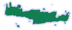
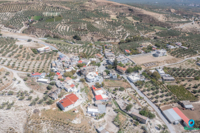
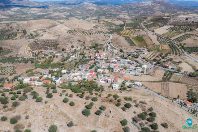
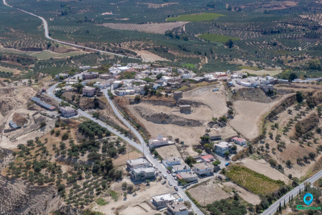
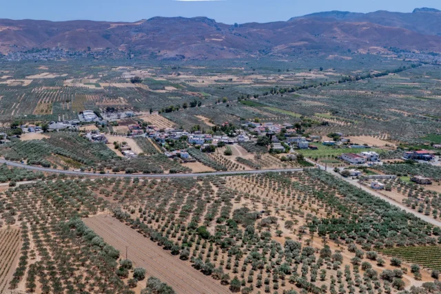
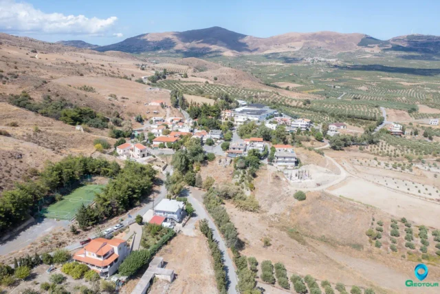
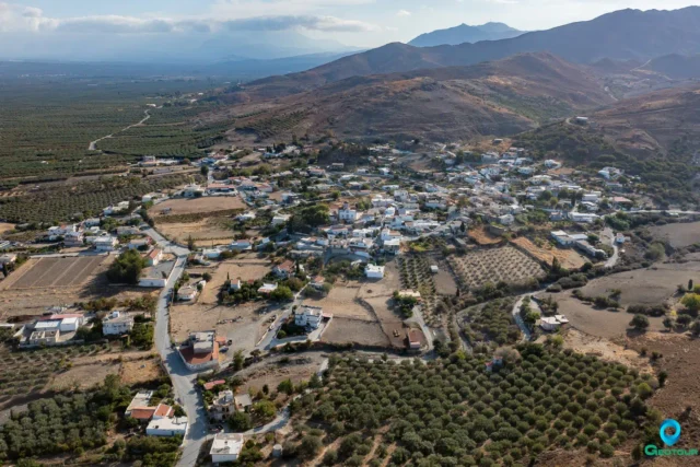
Sokaras is a village and the seat of the Sokaras community in the municipality of Gortyna in the Heraklion regional unit of Crete. It is located 49.7 km from Heraklion and is accessible via paved roads from the west (Assimi), east (Praetorians junction), north (Tsifout Kasteli), and south (Harakas).
Economy and Amenities
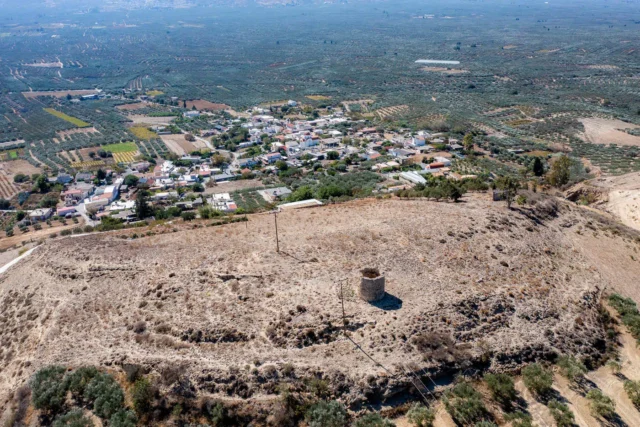
The inhabitants of the village are mainly farmers, producing olive oil, raisins, and vegetables. Before and after World War II, the village primarily produced wheat and tobacco. The village has a kindergarten and a primary school, two squares, a small playground, an outdoor basketball court, and a 5×5 football field built above Farangiana. This area also features an amphitheater with a view of the Messara plain and a small forest planted by the community residents. Traditional cafes in the village offer homemade meze and local raki/wine. A spring in Farangiana provides good quality drinking water year-round.
Religious Sites
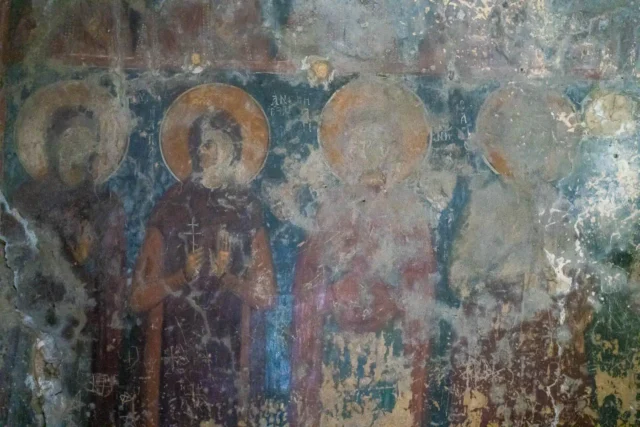
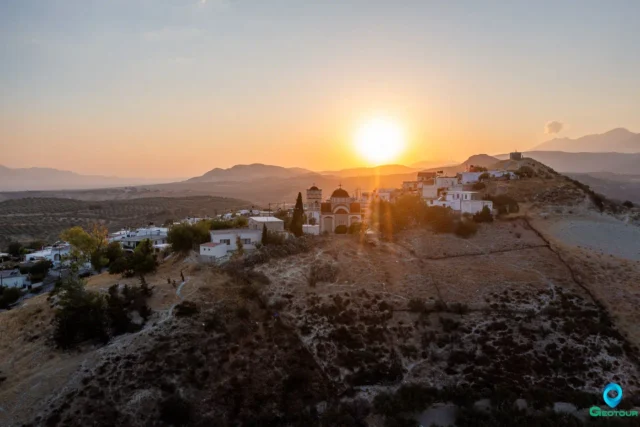
Sokaras has several churches: Agios Georgios, Agios Antonios, Panagia, Agios Ioannis (cemetery) with some remaining frescoes, Agioi Deka, and several chapels (Profitis Ilias, Christos, Metamorphosis, Agia Anastasia, Agia Christina, Agioi Saranta, and Agios Nektarios). Farangiana has the Panagia church (cemetery) and Metochia has the Agios Vasileios church.
The patron saint of the village is Agios Georgios, celebrated annually on November 3rd (Agios Georgios “the Drunkard”). This celebration involves a procession of the saint’s icon through the village, accompanied by horsemen, omelets offered by the village housewives, rabbits roasted by the hunters, and lambs brought by the farmers. All the food and wine are blessed and shared with the people after the service, creating an impromptu feast that lasts until late afternoon.
Other notable religious sites include:
- Panagia Velouliani: Located in the now-uninhabited Velouli, east of Sokaras. This single-aisled, vaulted Byzantine church belongs to the Holy Monastery of Sinai and features frescoes. The date 1209 is engraved above the entrance, possibly referring to its construction or renovation.
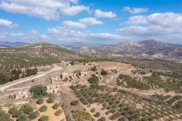
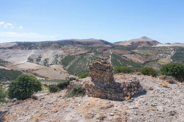
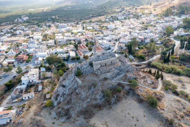
- Stravoras: A hill east of Sokaras where a medieval settlement with several churches once existed, now with only a few ruins remaining.
Archaeological Sites
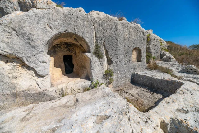
- Vakiotes: An east of Sokaras near Velouli, on a hilltop. This Hellenistic/Greco-Roman acropolis shows signs of habitation from the Geometric period (1050-700 BC) to the Ottoman period. It is considered a “carved acropolis” due to the number of houses and tombs carved into the soft rock, along with several wine presses. The site is among the most important of its kind in Crete. Vakiotes may be connected to the worship of Bacchus (Dionysus), the ancient god of wine, due to the presence of the wine presses. Ruins, possibly of a single-aisled vaulted church and an old windmill called “Zouridi mill”, exist west of the archaeological site.
- Mesominoan Period House: A house from the Mesominoan period (1700 BC) with 2-3 rooms and numerous findings, excavated north of the village. There are also indications of Minoan and Roman period cemeteries in the wider area.
Historical References
- Venetian Period: Sokaras is mentioned in a 1271 contract and in 16th-century Venetian censuses as “Socará” with 84 inhabitants in 1583. During Venetian rule (1217-1669), Sokaras belonged to the Monofatsi province.
- Ottoman Period: During Ottoman rule (1645/69-1898), Sokaras was a Turkish village with 38 Turkish families in 1834 and 393 people in 1881.
- Origin of the name: The name Sokaras is derived from the Byzantine surname Sokaras, meaning “rope weaver”. There are other theories about the origin of the name, including a Turkish derivation (“Su-Kara” meaning black water) and a connection to a general of Nikephoros Fokas named Sokarios.
- World War II: On August 17, 1944, German occupation forces executed 27 men from the village after a betrayal. This event significantly impacted the village’s modern history.
- Post-War Period: In 1959-60, the gendarmerie station was moved to the neighboring village of Assimi, leading to a conflict between the residents of Sokaras and the authorities.
Village Key Points
- Historical References: Venetian censuses (16th century), Ottoman records (1834, 1881).
- Location: 49.7 km from Heraklion, Crete.
- Historical Significance: Site of a mass execution during World War II, evidence of Minoan, Hellenistic, Roman, and Byzantine settlements.
- Population data over the years: 84 inhabitants (1583), 393 inhabitants (1881), 785 inhabitants (2011 census).
- Current Status: An active village with a mixed economy based on agriculture and tourism.
Reference
Access
Sokaras is 17.3 kilometers away from the town Arkalochori and 2.4 kilometers away from Asimi


There are no comments yet.