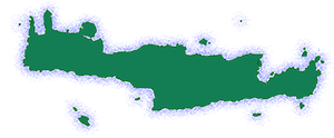
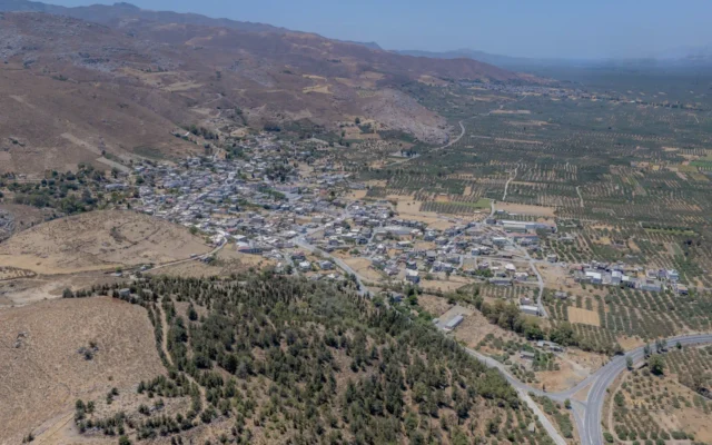
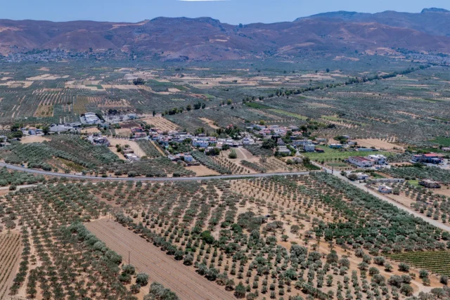
Rotasi is a village and the current seat of the Ethia community in the Municipality of Archanes-Asterousia, located in the Heraklion regional unit on the island of Crete, Greece. It previously belonged to the Monofatsi province within the Heraklion Prefecture. Situated at an altitude of 280 meters, Rotasi is approximately 51 kilometers from the city of Heraklion. The village lies at the foothills of the Asterousia Mountains. Under the Kapodistrias Plan, it was incorporated into the Municipality of Asterousia. The primary occupation of the residents is agriculture. The village also has an elementary school.
Historical References
The documented history of Rotasi traces back to a 1301 contract, where it is referenced under the name “Rutasi.” This establishes its existence during the Venetian period in Crete. Later records from 1583, referring to the village as “Rottassi” with 161 inhabitants, further solidify its historical presence. The village’s demographic composition shifted significantly during the Ottoman occupation, becoming predominantly inhabited by Turks, as evidenced by the 1881 census data showing 116 Turkish residents and only 4 Christian residents.
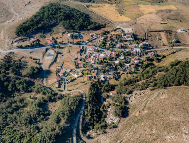
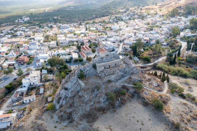
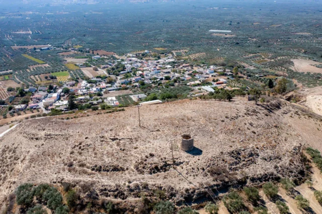
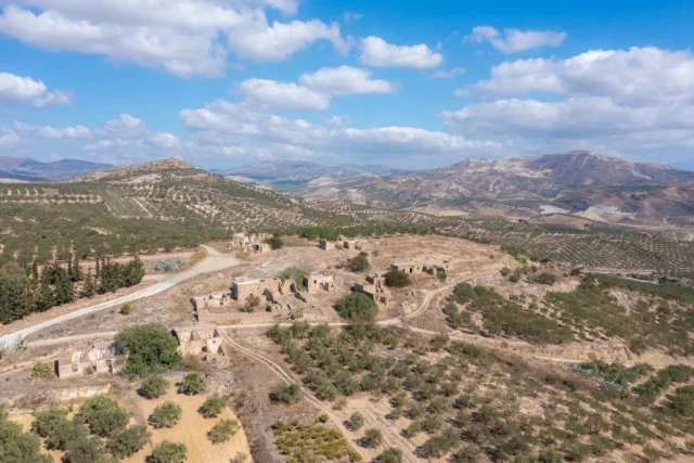
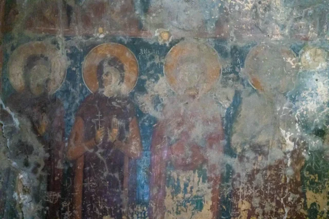
Beyond the village itself, the nearby hill of Rotasani Kefala holds immense historical significance. It is believed to be the site of the ancient city of Rhytion or Rhytiassos, mentioned in Homer’s epic poems. This connection to ancient Greece adds another layer of historical depth to the area, suggesting a continuous human presence dating back to the Bronze Age. Archaeological findings, including remnants of walls, cisterns, and Byzantine churches, further support this claim.
Location
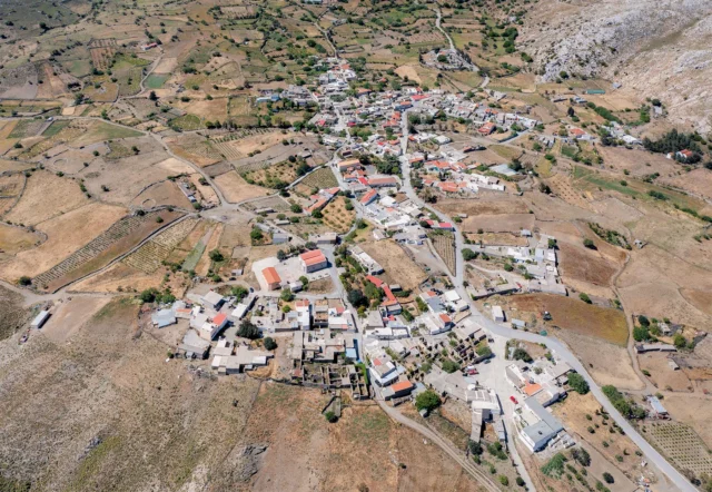
Rotasi’s location at the foothills of the Asterousia Mountains has played a crucial role in shaping its history and character. Situated at an altitude of 280 meters, the village enjoys a strategic position, offering both access to the fertile Messara Plain to the north and a connection to the rugged mountain terrain to the south.
Population Data Over the Years
Year |
Population |
|---|---|
1900 |
27 |
1920 |
106 |
1928 |
156 |
1940 |
221 |
1951 |
277 |
1961 |
440 |
1971 |
469 |
1981 |
451 |
1991 |
329 |
2001 |
329 |
2011 |
233 |
Historical Significance
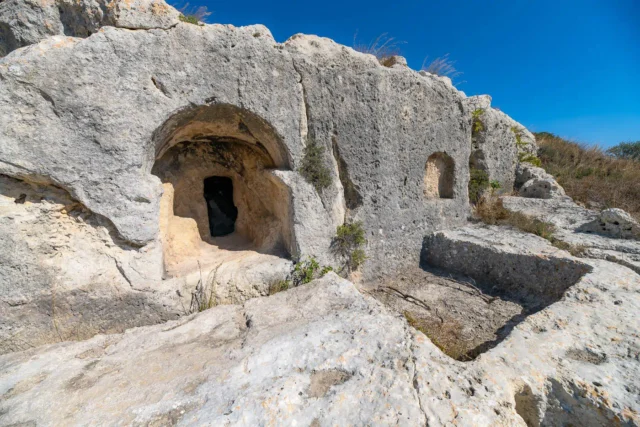
The nearby hill of Rotasani Kefala is believed to be the location of the ancient city of Rhytion or Rhytiassos, mentioned by Homer. The city was subjugated by the Gortynians, and an inscription from the Roman period refers to “Rhytiassion village and the sanctuary of Skylios Zeus.” Remnants of walls, cisterns, and the ruins of three Byzantine churches with traces of frescoes attest to the continued habitation of the village into the Byzantine era. Bronze tools and weapons dating back to the First and Second Late Minoan periods have also been discovered, indicating the presence of a prehistoric settlement in the same area.
The present-day name of the village, Rotasi, is believed to be derived from the ancient ethnic term “Rhytiassios,” which evolved over time to “Rhytiasioi,” “Rotasoi,” and finally “Rotasi.”
An extensive cemetery dating back to the Geometric period has been discovered in the village at the site of Farmakara. Additionally, a treasure trove of bronze tools and weapons, including chisels, cutters, and axes, was found at Asprolivada. Not far from the village, an undisturbed tholos tomb from the Geometric period was excavated, containing over 250 vases, urns with the ashes of the deceased, and other artifacts. The tomb was in use from the Protogeometric period to the beginning of the Orientalizing Geometric period. Iron weapons, fibulae, brooches, silver and gold pins, and gold rings were also found.
Hiking and Exploration
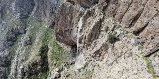
Rotasi serves as a starting point for a scenic hiking trail that leads to the village of Ethia and further into the Vornou Gorge (also known as the Ethia Gorge or Chavga Gorge). The trail offers stunning views of geological formations, including the “Tafkos tou Peristera” (Pigeon’s Nest), a sinkhole 15-20 meters deep formed by the collapse of a cave roof, and the “Roussos Egremos” (Russian Cliff), a complex of limestone folds culminating at “Langada stis Trypes” (Valley of the Holes), where a water source is located.
The trail continues through fields towards Ethia, where hikers can visit the visitor information center to learn about the protected Asterousia region, watch documentaries, obtain brochures, and even camp overnight if desired.
For experienced hikers and climbers, the trail further extends into the Vornou Gorge, following an old goat path that is now difficult to discern. This challenging route features exposed sections and requires careful navigation. Hikers are advised to obtain GPS coordinates from the Municipality’s website and inquire with local shepherds about specific locations and landmarks.
Current Status
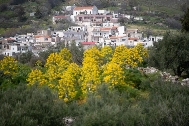
Rotasi exists as a small, tranquil agricultural village with a population of 233, according to the 2011 census. The villagers primarily engage in agriculture and animal husbandry, maintaining a deep-rooted connection to the land and traditional practices. The presence of cafes, grocery stores, and taverns suggests a self-sufficient community with basic services available to its inhabitants and visitors.
Rotasi’s allure extends beyond its agricultural character. The village’s historical and archaeological significance, coupled with its scenic location at the foothills of the Asterousia Mountains, attracts visitors interested in exploring Crete’s rich past and natural beauty. The well-marked hiking trail leading to Ethia and the challenging path into the Vornou Gorge offer opportunities for outdoor enthusiasts to immerse themselves in the stunning landscapes of the region.
Village Key Points
- Historical References: The village is mentioned in a contract from 1301 as “Rutasi” and in 1583 as “Rottassi” with 161 inhabitants. During the Ottoman period, it was predominantly inhabited by Turks.
- Location: Rotasi is situated at the foothills of the Asterousia Mountains, approximately 51 kilometers from Heraklion.
- Historical Significance: The village’s history dates back to at least the 14th century. It was primarily inhabited by Turks during the Ottoman period. The nearby hill of Rotasani Kefala is believed to be the site of the ancient city of Rhytion or Rhytiassos, mentioned by Homer.
- Current Status: Rotasi is a small agricultural village with a population of 233. The main economic activities are agriculture and animal husbandry. The village has an elementary school and serves as a starting point for hiking trails in the Asterousia Mountains.
Access
Rotasi is 17.4 kilometers away from the town Arkalochori and 1.9 kilometers away from Pyrgos


There are no comments yet.