


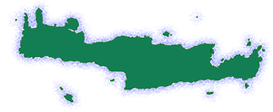
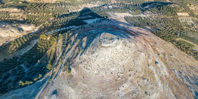
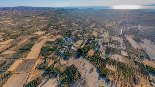
The Messara Plain, located in the south of Heraklion regional unit on the island of Crete, Greece, is the largest plain in Crete, measuring 55 km (34 mi) in length. The plain is bordered to the north by the Psiloritis mountain range and to the south by the Asterousia Mountains. The western side of the plain features a vast coastline on the Messara Bay, part of the Libyan Sea, with beautiful beaches such as Kokkinos Pyrgos, Kalamaki, Kommos, Matala, Lentas, Kali Limenes, Treis Ekklisies, and Tsoutsouras. The plain extends inland from east to west, reaching the foothills of Mount Dikti near Viannos in the east. The Geropotamos River flows through the plain and empties into the Messara Bay, with tributaries including the Koutsoulidis and Mageras rivers.
Geography and Climate
The Messara Plain is characterized by its fertile soil and warm climate, making it ideal for agriculture. The main crops cultivated in the plain are olives, grapes, and vegetables. The wild beauty of the surrounding gorges, such as Martsalo, Agiofarago, Trypiti, Rouvas, Vorizion, and the Kamares Cave, along with the idyllic beaches, attract visitors from around the world. The plain is divided into two basins, the upper and lower Messara, by a low elevation at the village of Asimi. The upper Messara is traversed by the Anapodaris River, which has several dams and reservoirs along its tributaries. The plain also features an artificial lake, the Faneromeni Dam, created for irrigation purposes. The total length of the plain is approximately 55 kilometers.
Settlements
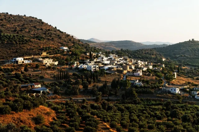
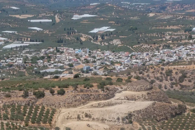
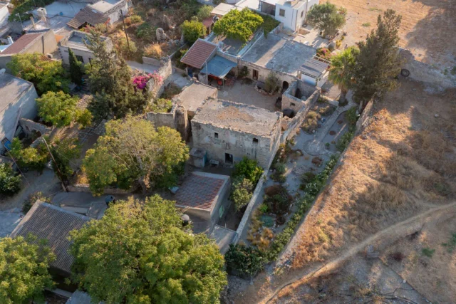
The Messara Plain is home to several traditional villages, where the majority of the population is engaged in agriculture and livestock farming. Some of the larger villages in the northern part of the plain, at the foot of Psiloritis, include Kamares, Vorizia, Zaros (with its lake), Gergeri. Further down towards the valley are Tymbaki, Moires, Pompia, Petrokefali, Kamilari, Pitsidia, and Agioi Deka. The villages and towns closer to the sea, on the western side, are more developed for tourism. The largest town in Messara is Mires, located in the middle of the plain, while Tymbaki is the largest town near the coast.
Archaeological Significance
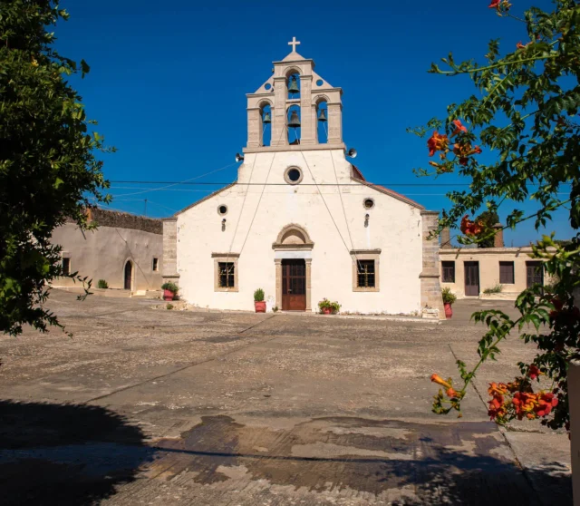
The Messara Plain boasts two of the most significant archaeological sites in the world: Phaistos and Gortyn. Other lesser-known but important archaeological sites include Agia Triada, Kommos, and Matala. The plain also hosts the “Messara Agricultural Exhibition,” a biennial event held in Voroi since 1988, which has contributed to the agricultural development of the region.
Historical Significance
The unique geomorphology and hydrology of the western Messara Plain have been crucial factors in human settlement and the development of communities since the Neolithic period (7000-3000 BC). Early traces of habitation are found on the plain and near the small natural harbors along the southern coast of the Asterousia Mountains. During the Early Bronze Age (Prepalatial period/3000-1900 BC), settlements increased in number, and social organization became more complex, as evidenced by the collective burials and rituals in tholos tombs characteristic of this period.
The beginning of the 2nd millennium BC saw economic and social developments that led to the establishment of the first palace at Phaistos (Old Palace period/1900-1700 BC). This palace aimed to systematically exploit the land and agricultural surplus through an organized system of product management and trade. After the destruction of the first palace, despite the construction of a new one (New Palace period/early 16th century BC), the central administration seems to have shifted to the Royal Villa of Agia Triada. The port of Kommos emerged as the main port of the palatial center, accumulating wealth from the flourishing trade. Following the final destruction of the palace at Phaistos and the establishment of Mycenaean rule in Crete (1450-1430 BC), Agia Triada evolved into a local center of power under the control of the palace at Knossos. The cultural fusion resulting from the encounter between Mycenaean and Minoan civilizations came to an end around 1200-1100 BC.
Gortyn
According to the prevailing view, Gortyn was named after Gortys, the son of Radamanthys, who was the king of Phaistos and brother of Minos. However, Phaistos predates Gortyn as a dominant power. Homer mentions Phaistos in both the Iliad and the Odyssey, highlighting its involvement in the Trojan War. Historically, Gortyn succeeded Phaistos and later Knossos, becoming the dominant power not only in Messara but throughout Crete from the mid-1st millennium BC onwards. During the Roman era, Gortyn served as the capital of Crete, succeeding Knossos, and remained the capital of the Roman province of Crete until the Arab conquest in 828 AD. Gortyn experienced its peak between the 2nd century AD and the early Christian centuries (7th century AD), succeeding Phaistos and Knossos. It was not only the political but also the religious center of Crete, associated with the Apostle Paul and Saint Titus, the first bishop of Crete. The significance of the Messara region extends beyond Cretan history and the spread of Christianity. It also encompasses the unique, in world history, recording of legal rules, demonstrating the high level of civilization in the area compared to the rest of the world at that time.
Some Points of Interest
-
Phaistos:
- Construction Period: Primarily Minoan, with some later additions.
- Location: Southern Crete, Messara Plain
- Historical Significance: One of the major Minoan palaces, center of political and economic power.
- Current Status: Archaeological site, partially restored.
-
Gortyn:
- Construction Period: Various periods, from Minoan to Roman.
- Location: Southern Crete, Messara Plain
- Historical Significance: Capital of Crete during Roman times, known for its legal code and diverse architecture
- Current Status: Archaeological site, with some well-preserved structures.
-
Agia Triada:
- Construction Period: Minoan
- Location: Southern Crete, Messara Plain
- Historical Significance: Minoan villa, possibly a royal residence or administrative center
- Current Status: Archaeological site
-
Kommos:
- Construction Period: Minoan
- Location: Southern Crete, Messara Plain, on the coast
- Historical Significance: Important Minoan port town, linked to the palace at Phaistos
- Current Status: Archaeological site
-
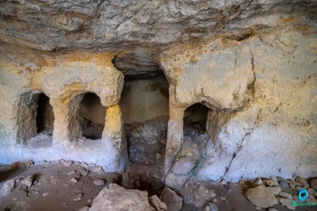
Matala:
- Construction Period: Primarily Roman, with earlier Minoan presence
- Location: Southern Crete, Messara Plain, on the coast
- Historical Significance: Roman port and settlement, known for its artificial caves used as tombs
- Current Status: Archaeological site and popular tourist destination


There are no comments yet.