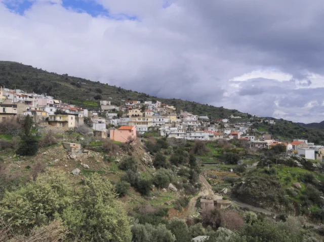
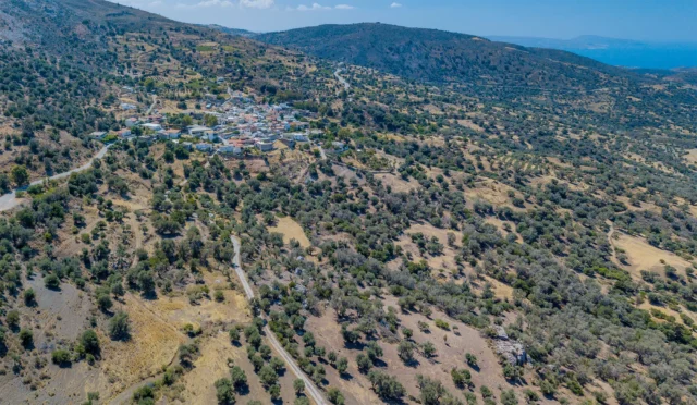
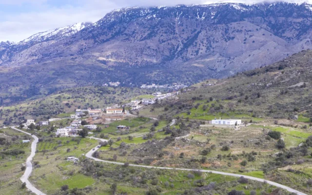
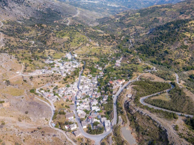
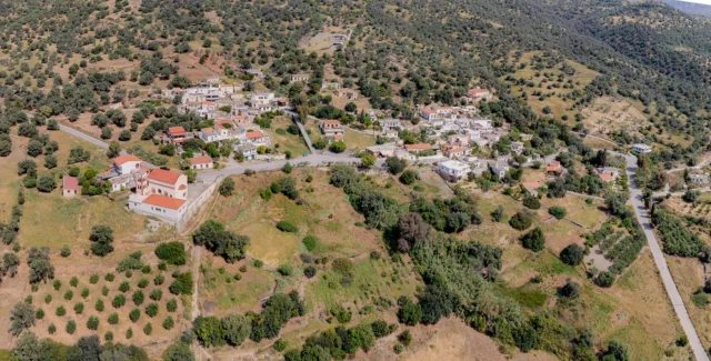
Lochria is a village and the seat of the homonymous community in the Amari Municipality, in the Rethymno regional unit of Crete, Greece. It is 61 kilometers from Rethymno and 56 kilometers from Heraklion. It is built at an altitude of 580 meters in a valley. It is located near the border of the prefectures of Rethymno and Heraklion. The economy of the village is mainly agricultural and livestock, while there is also a gas station, two bakeries and a commercial store in the village.
Historical References
The village is mentioned by Francesco Barozzi in 1577 as Loghrea. In the Venetian census of 1583 by Castrofylakas it is mentioned as Oghrea with 68 inhabitants and in the census of Basilicata in 1630 it is mentioned as Locrea. Although the village belongs to the villages of Ampadia, no Muslims lived in it. In the census of 1834 which was carried out by the Egyptians, 6 Christian families were recorded. In the 1881 census it had 80 Christian inhabitants and belonged to the municipality of Apodoulou. In the 1900 census it had 160 inhabitants. In the 1920 census it is mentioned that it belonged to the community of Platanos. In 1927 it was designated the seat of the homonymous community until the Kapodistrian administrative division, when it was annexed to the Municipality of Kouriton.
On May 4, 1944, German troops invaded the village, removed the residents and then separated men and women. Of the men, they executed three in the village and transported the rest to Moires, where they imprisoned them. They then transferred eight of them to the Agia prison, where they are believed to have been shot. Then they destroyed all 215 houses in the village, after having looted them first.
Location & Dimensions
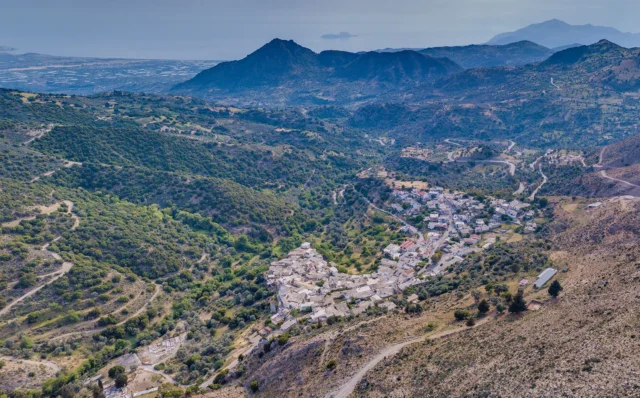
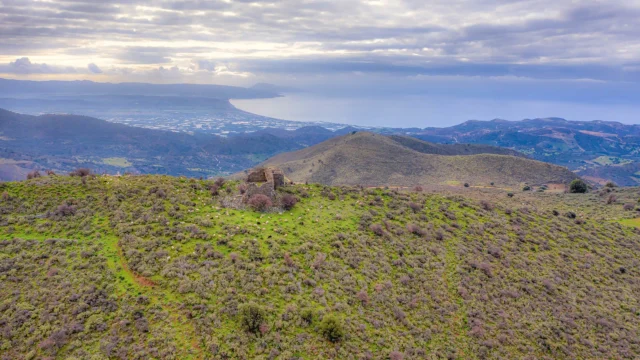
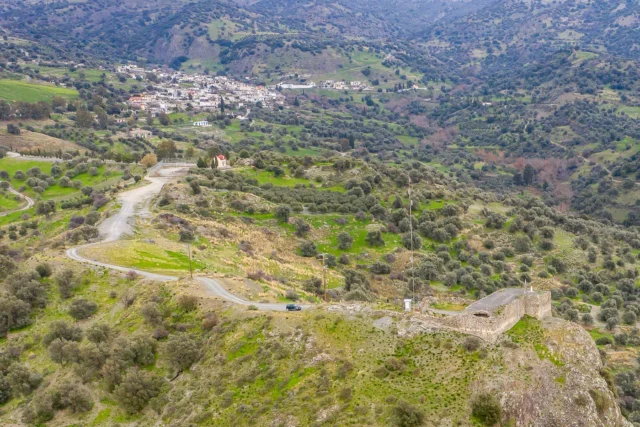
Lochria is situated within a picturesque valley in the Amari region, strategically positioned near the border between the Rethymno and Heraklion prefectures. The village sits at an elevation of 580 meters above sea level, offering a pleasant climate with cooler temperatures compared to the coastal areas. This elevated position provides scenic views of the surrounding landscape, including the majestic peaks of Psiloritis to the north and the rolling hills of the Amari valley. The village is characterized by its traditional stone houses, narrow streets, and a central square that serves as a gathering place for the community. While the exact dimensions of Lochria are not readily available, its compact size and valley setting create an intimate and close-knit atmosphere.
Historical Significance
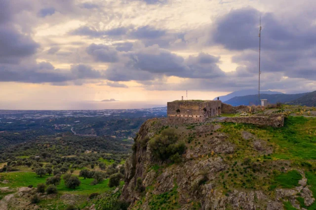
Lochria’s historical significance is intertwined with the broader narrative of Crete’s struggles for freedom and resilience in the face of adversity. The village’s origins can be traced back to at least the Venetian era, with documented references dating back to 1577. While it remained untouched by the Ottoman influence that swept through many other Cretan villages, Lochria was not spared the ravages of war. During World War II, the village was tragically destroyed by German troops in 1944, a stark reminder of the sacrifices made by the Cretan people during the occupation.
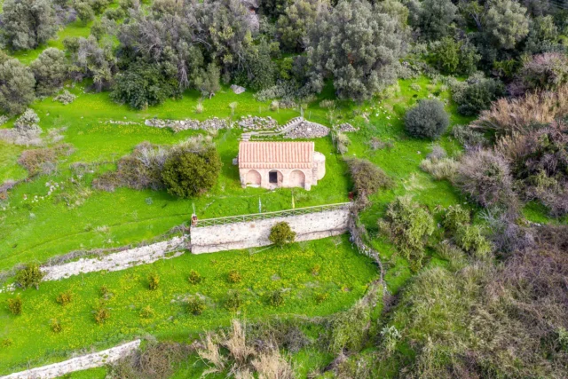
Beyond its wartime experiences, Lochria also boasts a rich cultural heritage. The Byzantine church of Agios Nikolaos, dating back to the 11th-12th centuries, stands as a testament to the village’s enduring religious traditions. The presence of this church, along with other historical landmarks, underscores Lochria’s deep-rooted connection to the island’s past.
Population data over the years
Census Year |
Population |
|---|---|
1900 |
160 |
1920 |
169 |
1928 |
196 |
1940 |
282 |
1951 |
233 |
1961 |
234 |
1971 |
207 |
1981 |
224 |
1991 |
249 |
2001 |
271 |
2011 |
247 |
Current Status
Today, Lochria is a vibrant community that has rebuilt itself from the ashes of war. Its primary economic activities remain centered around agriculture and livestock farming, reflecting the village’s close relationship with the land. The presence of a gas station, two bakeries, and a commercial store indicates a degree of self-sufficiency and caters to the needs of both residents and visitors.
The village’s cultural life revolves around its churches, particularly the newer church of Agios Konstantinos and Eleni, which serves as the focal point for religious celebrations and community gatherings. The surrounding natural beauty, with its scenic valley and proximity to Mount Psiloritis, attracts hikers and nature enthusiasts, contributing to the village’s growing tourism sector.
Village Key Points
- Historical References: Mentioned in Venetian documents as early as 1577, destroyed by German troops in 1944.
- Location: Situated in a valley at an altitude of 580 meters, near the border of Rethymno and Heraklion prefectures.
- Historical Significance: Features a Byzantine church, was destroyed during World War II, and had a primary school until 2001.
- Population data over the years: The population has fluctuated, with a peak of 294 inhabitants in 1991. As of 2011, the population was 247.
- Current Status: Primarily agricultural and livestock economy, with some commercial establishments. Features several churches and is accessible via the Provincial Road 13.
Access
Lochria is 9.6 kilometers away from the town Tympaki and 9.1 kilometers away from Fourfouras


There are no comments yet.