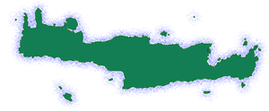
Koustogerako is a small village situated in the White Mountains of Crete, within the municipality of Kantanos-Selino, Chania regional unit. It lies at an altitude of 510 meters and is located approximately 73 kilometers southwest of Chania town, near the village of Sougia. Historically part of the Selino province, Koustogerako is known for its resilient spirit, having endured destruction and hardship throughout its history while playing an active role in Cretan uprisings against foreign powers.
Historical Overview
Venetian Era: The village is mentioned in the Chrysobull (golden bull) of the Twelve Archontopoula, a document from the Venetian period, where it is referred to as “Christou to Geraki” (The Hawk of Christ) and marked the boundary of the Skordilis family’s territory. Koustogerako was the birthplace of Georgios Kantanoleon, the leader of a 1527 revolt against the Venetians. This uprising, known as the Kantanoleon Revolt, was ultimately unsuccessful, and Venetian forces retaliated by destroying Koustogerako and executing many of its inhabitants.
Despite this setback, the village was re-established. A ducal document from 1536 mentions it as “Cristogeraca.” The census of Francesco Barozzi in 1577 lists it as “Christogeraco” in the Selino province. The Venetian census of 1583 by Castrofylaka includes it among other villages in the region. Francesco Basilicata, in 1630, and Antonio Trivan, in his chronicle, also refer to the village as “Christogeraco.”
Ottoman Era: During the Greek War of Independence in 1821, Koustogerako was burned by Hussein Pasha, but it was once again re-inhabited. The Egyptian census of 1834 lists it as “Krustogheraco” with an entirely Christian population of 20 families. Michael Chourmouzis mentions the village as “Kostogerako” in his work “Cretica.” In 1881, Koustogerako belonged to the municipality of Kampanos and had a population of 60.
20th Century: In the 1900 census, the population had grown to 134. By 1920, it was part of the rural municipality of Sougia. In 1925, Koustogerako was attached to the community of Moni, where it remained until the Kapodistrian administrative reform of 1997, when it became part of the Anatoliko Selino municipality.
World War II: During World War II, Koustogerako played an active role in the Cretan resistance against the German occupation. Locals, with the support of British forces, organized resistance efforts. In November 1942, the British Forward Force 133 was established in the village to disrupt the German supply lines to North Africa. In retaliation, German forces bombed the village on September 28th, 1943, and then surrounded Koustogerako, along with the villages of Moni and Livada, with the intention of eliminating their inhabitants. In Koustogerako, they gathered the women and children for execution, but resistance fighters intervened, forcing the Germans to retreat with significant losses. The area was then declared a “dead zone” by the Germans, and anyone found there faced the death penalty. This remained in effect until the fall of 1944.
Population Data
Year |
Population |
|---|---|
1900 |
134 |
1920 |
150 |
1928 |
166 |
1940 |
166 |
1951 |
132 |
1961 |
174 |
1971 |
115 |
1981 |
75 |
1991 |
76 |
2001 |
76 |
2011 |
44 |
2021 |
25 |
Points of Interest
Churches: Koustogerako has two main churches of historical and architectural interest:
- Agios Georgios: A single-nave church with a vaulted roof, dating back to 1488. It features frescoes and a partially preserved inscription commemorating its founders, Kontoleos Makanaris and Martha Thetokopoulina.
- Panagia: A double-nave church dedicated to the Virgin Mary, located on a hill at the edge of the village. Both naves are decorated with frescoes from different periods. The church has been largely reconstructed, with only a portion of the original eastern wall remaining.
Other Points of Interest:
- Cave of Polyphemus: Located between Sougia and Koustogerako, this cave is associated with the mythical Cyclops Polyphemus from Homer’s Odyssey. It is said that Polyphemus imprisoned Odysseus and his companions in this cave.
- Kastelos: Ruins of an ancient settlement can be found at a location called Kastelos.
- War Memorial: A monument commemorating those executed by the Nazis during World War II stands near the entrance to the village.
- Agia Aikaterini Church and Festival: A small church dedicated to Saint Catherine is located about three kilometers from Koustogerako. It was built after World War II by Cretan resistance fighters who had taken refuge in a nearby cave and vowed to build a church if they escaped the Germans. A festival is held at the church every year on November 25th.
Village Key Points
- Historical References: Mentioned in Venetian-era documents as early as the 15th century. Associated with the Kantanoleon Revolt of 1527.
- Location: Chania regional unit, Crete, Greece. 73 km southwest of Chania town, near Sougia, in the White Mountains.
- Altitude: 510 meters above sea level.
- Historical Significance: Historically a center of resistance against Venetian and Ottoman rule. Played an active role in the Cretan resistance during World War II.
- Current Status: A small, quiet village with a strong historical legacy.
Access
Koustogerako is 15.1 kilometers away from Palaiochora and 4.0 kilometers away from Sougia


There are no comments yet.