Location and History
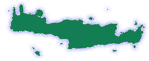
Hyrtakina was a Cretan city located in the Oreia region, in the southwestern part of the White Mountains. The city was situated on the ‘Kastri’ hill, near the village of Temenia, in the Chania prefecture. The Oreia region was geographically isolated, with only one opening to the Libyan Sea.
Hyrtakina was one of the cities that constituted the League of the Oreioi. The league was a federation of cities that was formed primarily for security and economic development. Member cities included Elyros, Hyrtakina, Lissos, Poikilasio, Syia, and Tarra. The league likely dissolved sometime before 183 BC, as many of its member cities, including Hyrtakina, began to appear independently in treaties.
Fortifications
The city of Hyrtakina was situated on a naturally fortified hill and surrounded by tracts of land. It was enclosed by strong double fortification walls. Outlines of buildings, some of which are believed to have served a public function, are preserved within the walls of the city. An open-air sanctuary of Pan was also discovered within the city walls.
Coinage
The city of Hyrtakina minted its own coins, suggesting it was an autonomous state. The coins featured the head of a wild goat on the obverse and a bee on the reverse.
Ports
The region of Oreia had only one opening to the Libyan Sea, which made the port of Lissos a major contributor to the economic development of the region. Lissos was an important religious center that contained a panhellenic Asklepieion, or healing temple.
Relationship with other cities
A silver tetradrachm of the city of Cyrene was found on Crete and overstruck by the city of Hyrtakina. The coin was likely minted in Cyrene between 331-322 BC and overstruck in Hyrtakina between 322-300 BC. The overstriking of this coin provides evidence of the interaction between these two cities during this time period.
Hyrtakina was one of the five cities, including Kydonia, Knossos, Gortyn, and Elyros, that made an agreement with Cyrene for the supply of grain, free or at a reduced price. This agreement likely occurred around 330-326 BC, when many of the cities on Crete were experiencing a grain shortage.
Archaeological Findings
Based on archaeological findings, Hyrtakina had communication with cities in mainland Greece, North Africa, and Southern Italy. Stray finds date the settlement to the early Iron Age, but the city reached its peak in the 4th century BC, coinciding with the time it began minting its own coins. The city was abandoned in Roman times, but the reasoning for this desertion remains unclear.
Site: Key Points
- Construction Period: Early Iron Age (11th-10th century BC)
- Location: ‘Kastri’ hill, near the village of Temenia, in the Chania prefecture.
- Fortification: Double fortification walls.
- Historical Significance: One of the cities of the League of the Oreioi. Minted its own coins.
- Current Status: Abandoned.
References
- Pollard, D. (2022). Between the Mountains and the Sea: Landscapes of Settlement, Subsistence, and Funerary Practice in Later Bronze Age and Iron Age Crete (Doctoral dissertation). University College London.
- Mlinar, E. (2007). Fortified towns, settlements and other strongholds on Crete from Archaic through Hellenistic times. In Proceedings of the 10th International Cretological Congress (pp. 23-32).
- Tzanakaki, K. (2019). Ancient cities of westernmost Crete (Prefecture of Chania): Kydonia, Aptera, Polyrrhenia, Phalassarna, Hyrtakina, and Elyros. In N. C. Stampolidis, D. I. Tsangari, and M. Giannopoulou (Eds.), Cretan Cities: The Testimony of Coins (pp. 35-43). Alpha Bank.
- Stefanakis, M. I. (2016). Looking towards the North: The Circulation of Cyrenaic Coins on Crete. In M. Asolati (Ed.), Le monete di Cirene e della Cirenaica nel Mediterraneo: problemi e prospettive (pp. 65-81). Esedra.


There are no comments yet.